
Callicoma Falls
North Coast NSW
Dorrigo National Park


A lovely and less popular waterfall along a small rock face, that is part of the longer Blackbutt Track, but can be shortened to just see the falls.
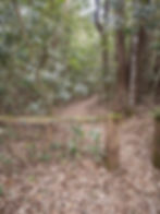
This lightly trafficked walk starts from a small car park on the right-hand side of Dome Road, approximately 600 metres after entering the Never Never section of the park. There is a wooden fence with a sign that reads ‘Walking Track Only’.
The falls are located along the Blackbutt Track, a 6.4 km one-way track that is one of the lesser trafficked walks in the area, however can be shortened considerably to just see the falls.
The walk is a gradual descent through lovely rainforest along a graded path. Callicoma Falls is located along Endiandra Creek, approximately 1.4 kms into the Blackbutt Track.
While small, at approximately 6 metres, the falls are quite beautiful, cascading down the far end of a long rock face into a series of clear, shallow pools at the base, with lovely smooth creek stones.
From the falls, simply retrace your steps back to the car park.
If you’re keen on stretching your legs further, you can continue along the Blackbutt Track, which takes you through lush rainforest and offers scenic views of the park. It is a challenging grade 4 track with a number of steep sections and can be prone to debris on the track after bad weather.
Just note that the Blackbutt Track is 6.4 kms one-way, so 12.8 kms return if not doing a car-shuffle. While the full track also takes in Casuarina Falls, it is suggested that these falls be added to the Rosewood Creek Circuit instead.
Dorrigo National Park can be visited as part of the 185 km Waterfall Way scenic drive from Coffs Harbour to Armidale.
Track: Graded and well-signed, the track to Callicoma Falls is easy to follow. The loop circuit only has a small amount of elevation change, but there is a short steep descent to the falls, meaning the return is primarily uphill.
Difficulty: The track is suitable for most fitness levels, with only gradual elevation on the return leg.
Direction: This is an out-and-back track that returns the way you came. The full Blackbutt Track can be completed as a long out-and-back track, or as a one-way track with a car-shuffle.
getting there
The trail starts from a small car park on Dome Road in Dorrigo – in the Never Never Section of Dorrigo National Park – approximately 5 hours drive south of Brisbane, 1.5 hours drive east of Armidale, 1 hour drive west of Coffs Harbour or 6 hours drive north of Sydney.
The car park is located approximately 600 metres on the right-hand side after entering the Never Never section of the park on the way to the Never Never Picnic Area (approximately 4 kms before the picnic area).
Much of the road to the Never Never section of Dorrigo National Park is unsealed, however is suitable for 2WD vehicles in normal weather conditions.
Parking is limited, but the walk is only lightly trafficked.
best time to go
The walk can be completed year-round.
Like any walk involving waterfalls, it is best done after recent rain. However, if completing after recent rain, be sure to check the New South Wales Parks and Wildlife Service website for updates regarding flooding and track closures.
Note that there are park fees associated with entering many national parks in New South Wales. Check the New South Wales Parks and Wildlife Service website for more information.
Remember, whenever venturing into the outdoors, practice the Leave No Trace principles and be considerate of others. This means: dispose of your waste properly, don't remove things or move things from their natural position and respect all wildlife. Also be sure to plan ahead and adequately prepare for any adventure.
I respectfully acknowledge the Traditional Owners of the land on which all activities listed on this website are found, as well as Elders past, present and emerging. I strive to not promote sites where requests have been made for people not to explore due to the cultural significance of the site to Indigenous peoples, or note how to respectfully visit a site. If I have a promoted a site with cultural significance, please send me a message and let me know.