
Koonin Lookout & Pools Loop
Toowoomba
Crows Nest National Park

Ascend through eucalypt forest past rock pools, waterfalls and lichen stained granite formations, to an incredible lookout perched high above a gorge.
This lightly trafficked walk starts from the Crows Nest picnic area at the end of Park Road in Crows Nest.
While a straight out-and-back journey to the lookout is possible, it is highly recommended to include the Pools Loop, which only adds a few hundred metres additional distance, but includes some great scenery.
From the car park, walk through eucalypt forest along the graded track and look for wildlife.
The Pools Loop can either be done before or after the lookout. It is recommended to do it before if heading to the lookout in the afternoon, or after if doing the lookout for sunrise.
The Pools Loop includes three main side tracks – the Cascades, Kauyoo Pool and Bottlebrush Pool. At the Cascades, use the stepping stones to cross the river (avoid if flooded) and then explore the area, including sandy beaches that dip into the surrounding pools.
As you get closer to the cascades, the terrain shifts to steep crevices and slippery rocks, so care is needed. Keep an eye out for the cute local rock wallabies that inhabit this area.
Both Kauyoo Pool and Bottlebrush Pool offer a place to cool off and relax with a swim. At Kauyoo Pool, a sandy beach allows easy access to the normally shallow water.
At Bottlebrush Pool, she-oaks and bottlebrush trees provide a shadier location to cool off. Care is required when using the rock steps leading to the creek.
The track connecting the pools offers great elevated views down into the gully to the creek, as well as to the granite hills and lichen covered boulders that surround the pools. Rock wallabies are common in this area, so keep your eyes out for them.
After completing the Pools Loop, continue to the Crows Nest Falls Lookout, for a somewhat obstructed, side-on view of the 20m high falls, where water tumbles over the granite cliffs.
There is also great views to the rock pool at the bottom of the falls from the lookout, and to where the creek continues into the valley.
Access to the Crows Nest Falls waterhole is prohibited due to the danger posed by large rock falls, and a sign devoted to a young man who lost his life at the falls is a timely reminder to heed the warnings.
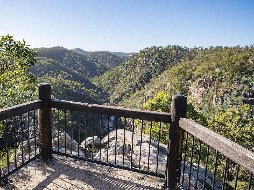
From here the track ascends to Koonin Lookout, an incredible viewpoint perched high above a gorge known as the Valley of Diamonds, and to where Crows Nest Creek splits into Cressbrook and Perseverance Creeks.
Views to the ranges of Ravensbourne are also provided from the lookout. Marvel at the granite formations that line the cliff edges.
The lookout is especially sensational for sunset and sunrise.
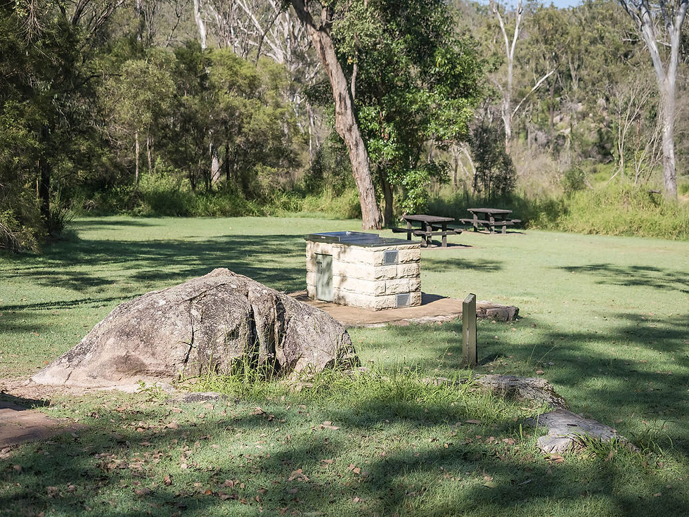
The day-use area has drop toilets, wood BBQs and both covered and open picnic tables. There is no camping or rubbish bins at the day-use area, however the Crows Nest camping area is located only a few hundred metres down the road.
Note: this track is an extension of the smaller Crows Nest Falls Lookout walk.
Track: Graded and well-signed, the track is easy to follow. There are a number of steps throughout the walk.
Difficulty: The track requires a moderate level of fitness, but is doable by most individuals with enough time. Care is required if exploring the Cascades and Pools, where rocky steps or rock hopping is required.
Direction: This is an out-and-back track that returns the way it came, with a loop circuit in the middle section.
getting there
The trail starts from the Crows Nest picnic area at the end of Park Road in Crows Nest, approximately 2.25 hours drive west of Brisbane.
Parking is ample for how trafficked the walk is.
best time to go
The walk can be completed year-round.
Like any walk involving creeks and waterfalls, it is best done after recent rain. However, if completing after recent rain, be sure to check the Queensland Parks website for updates regarding flooding and track closures.
Remember, whenever venturing into the outdoors, practice the Leave No Trace principles and be considerate of others. This means: dispose of your waste properly, don't remove things or move things from their natural position and respect all wildlife. Also be sure to plan ahead and adequately prepare for any adventure.
I respectfully acknowledge the Traditional Owners of the land on which all activities listed on this website are found, as well as Elders past, present and emerging. I strive to not promote sites where requests have been made for people not to explore due to the cultural significance of the site to Indigenous peoples, or note how to respectfully visit a site. If I have a promoted a site with cultural significance, please send me a message and let me know.