
Mount Mitchell
Scenic Rim
Main Range National Park (Cunningham's Gap)


An amazing hike through a variety of forest types for uninterrupted views across Lake Moogerah, Moogerah Peaks, Mount Barney and the Fassifern Valley.
This heavily trafficked hike starts from directly across the road from the Crest Car Park on the Cunningham Highway.
The track zig-zags up the mountain through a variety of forest types, including eucalypt forest and montane heath on the northern side of the mountain and lush subtropical rainforest on the southern side.
On the way up, look back for incredible views towards Mount Cordeaux, and spot the interesting rock formations the line sections of the path as you round to the southern side of the mountain.
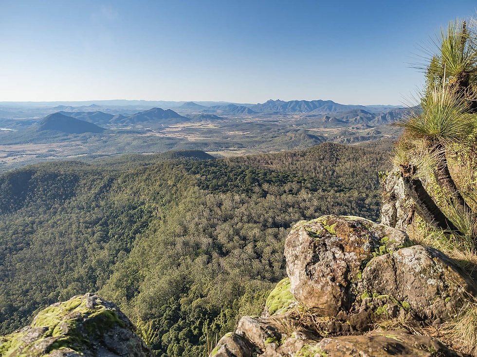
The track involves a steady climb up and around the West Peak (1,162m), through a saddle to a ridge on the East Peak (1,175m). The saddle is lined with moss and lichen covered rocks and trees and is enchanting on a misty morning.
The views from the summit are incredible, stretching across Lake Moogerah to the Fassifern Valley, as well as taking in the peaks of Mount Greville, Maroon, Lindesay, Barney, Spicer’s Peak and more.
There are also beautiful views west towards the Millar Vale Creek Valley and out towards Warwick.
The walk is great at any time, but particularly beautiful at sunrise and sunset.
Track: The track involves graded paths, with many rocky steps, and is well-signed and easy to follow.
Difficulty: The track is steep in sections, but achievable for anyone with moderate fitness. From the summit, and various locations along the track, there are sheer drops, so caution must be exercised.
Direction: The track is an out-and back that returns the way it came.
getting there
The trail starts from directly across the road from the Crest Car Park on the Cunningham Highway in Tregony, 1.5 hours drive south-west of Brisbane.
Extreme care should be taken when crossing the multi-lane road, particularly during busier times of the day and on weekends.
Parking can become extremely busy, particularly on weekends, so it is advised to go early or weekdays if possible.
best time to go
The walk can be completed year-round, however is exposed to the sun at the summit and on sections of the track, so would be more difficult during warmer months.
Always check the Queensland Parks website for updates on track closures.
Remember, whenever venturing into the outdoors, practice the Leave No Trace principles and be considerate of others. This means: dispose of your waste properly, don't remove things or move things from their natural position and respect all wildlife. Also be sure to plan ahead and adequately prepare for any adventure.
I respectfully acknowledge the Traditional Owners of the land on which all activities listed on this website are found, as well as Elders past, present and emerging. I strive to not promote sites where requests have been made for people not to explore due to the cultural significance of the site to Indigenous peoples, or note how to respectfully visit a site. If I have a promoted a site with cultural significance, please send me a message and let me know.