
Broadwater
Moreton Bay
D'Aguilar National Park (Mount Mee)

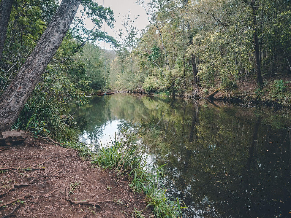

A short walk from a 4WD track to a beautiful swimming hole that is typically less populated than the nearby Rocky Hole.
This lightly trafficked, well-marked trail starts from a small car park on Lovedays Road (part of the Mount Mee Forest Drive - a 4WD track).
The easy walk heads down a small set of stairs through scrub forest to a beautiful natural swimming hole. This location is typically less crowded than the nearby Rocky Hole.
There are also toilets and some picnic tables located at the car park.
This walk is located on the Mount Mee Forest Drive, which also includes walks to Rocky Hole, Bulls Falls and Falls Lookout , The Mill Rainforest Walk and The Gantry.
Track: Graded and well-signed, the track is easy to follow.
Difficulty: The track is suitable for all fitness levels.
Direction: This is an out-and-back track that returns the way it came. For directions for the 4WD track, see the Mount Mee Forest Drive activity page.
getting there
The trail starts from a small car park on Lovedays Road in Mount Mee. There are two options for getting to Broadwater:
Combine it with the Mount Mee Forest Drive, which begins along Neurum Creek Road, near The Gantry, which is at the end of Sellin Road in Mount Mee, 1.25 hours drive northwest of Brisbane. This approach requires 19-34 kilomtres of beginner 4WD tracks, but includes other activities such as Bulls Falls and Falls Lookout, the Mill Rainforest Walk and Rocky Hole. A high-clearance 4WD is required when using this approach.
Alternatively, you can approach via Woodford, along Rasmussen Road, about 1.5 hours drive northwest of Brisbane. This approach includes unsealed roads, but can typically be done in a 2WD vehicle in dry weather conditions.
Parking is limited, but typically ample for how trafficked the location is.
best time to go
The walk can be completed year-round.
Always check the Queensland Parks website for updates on track closures.
Remember, whenever venturing into the outdoors, practice the Leave No Trace principles and be considerate of others. This means: dispose of your waste properly, don't remove things or move things from their natural position and respect all wildlife. Also be sure to plan ahead and adequately prepare for any adventure.
I respectfully acknowledge the Traditional Owners of the land on which all activities listed on this website are found, as well as Elders past, present and emerging. I strive to not promote sites where requests have been made for people not to explore due to the cultural significance of the site to Indigenous peoples, or note how to respectfully visit a site. If I have a promoted a site with cultural significance, please send me a message and let me know.