
Rocky Hole
Moreton Bay
D'Aguilar National Park (Mount Mee)

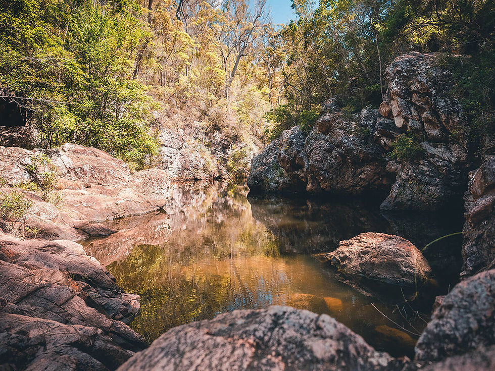

A short walk from a 4WD track to a beautiful natural swimming hole on Neurum Creek, surrounded by open eucalypt forest.
This heavily trafficked, well-marked trail starts from a small car park on the Mount Mee Forest Trail (a 4WD track).
The short track heads through open eucalypt forest to stairs that lead to a series of rock pools on Neurum Creek that are a great place to cool off on a hot day.
Rocky Hole is located in the Mount Mee section of D’Aguilar National Park, about an 8 kilometre drive by high-clearance 4WD from The Gantry.
The series of pools are mostly shallow, with only a few deep sections and many submerged rocks, so jumping and diving from the rocks surrounding the pools is not advised.
There are no toilets or other amenities at the pools, which become extremely crowded on weekends and in warmer weather.
This walk is located on the Mount Mee Forest Drive, which also includes walks to Bulls Falls and Falls Lookout, The Mill Rainforest Walk, Broadwater and The Gantry.
Track: Graded and well-signed, the track is easy to follow.
Difficulty: The track is suitable for all fitness levels.
Direction: This is an out-and-back track that returns the way it came. For directions for the 4WD track, see the Mount Mee Forest Drive activity page.
getting there
The trail starts from a small car park about 8 kilometres along the Mount Mee Forest Drive, which begins along Neurum Creek Road, near The Gantry, which is at the end of Sellin Road in Mount Mee, 1.25 hours drive northwest of Brisbane.
Parking is limited and the location gets extremely busy on weekends and in the warmer months.
A high-clearance 4WD is required to get to the walk.
best time to go
The walk can be completed year-round, however the pools are very exposed to the sun, with minimal shade, so avoiding the hottest part of the day is advised.
This site would also be extremely dangerous during heavy rain or shortly after, given the risk of flooding and dangers associated with it. Be sure to check the Queensland Parks website for updates regarding flooding and track closures.
Remember, whenever venturing into the outdoors, practice the Leave No Trace principles and be considerate of others. This means: dispose of your waste properly, don't remove things or move things from their natural position and respect all wildlife. Also be sure to plan ahead and adequately prepare for any adventure.
I respectfully acknowledge the Traditional Owners of the land on which all activities listed on this website are found, as well as Elders past, present and emerging. I strive to not promote sites where requests have been made for people not to explore due to the cultural significance of the site to Indigenous peoples, or note how to respectfully visit a site. If I have a promoted a site with cultural significance, please send me a message and let me know.